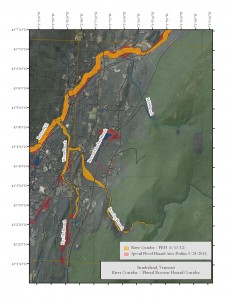
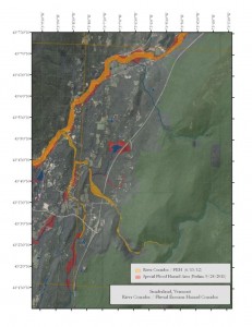
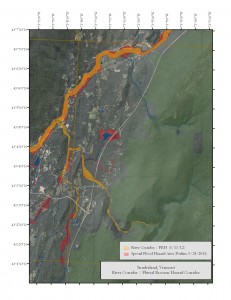
The December 2015 flood plain maps can be viewed on the Flood Ready Atlas tinyurl.com/floodreadyatlas . Use Flood Ready Tools to “Find Address” and “Toggle Flood Data On”. The older maps can be viewed on FEMA’s Map Service Center www.msc.fema.gov .
Live in Bennington County? Check the Flood Map! (6/9/15)
For more information about the Bennington County DFIRM visit www.vtfpm.blogspot.com
The Sunderland Flood Hazard Regulations have been approved by the State of Vermont as well as the Sunderland Selectboard and Planning Commission: Final Sunderland FHA regulations
Vermont has a website called Flood Ready Vermont which can be viewed here: www.floodready.vermont.gov
June 26, 2012 – Additional Flood Plain Maps and information provided by Ned Swanberg of the VT DEC is listed below:
Sunderland Flood Datasheet 6.18.12
River Corridor FEH Sunderland 6.13.12
To view high quality flood plain maps of the area you can visit the Vermont Natural Resources Atlas which is accessible from the following link: Vermont Natural Resource Viewer
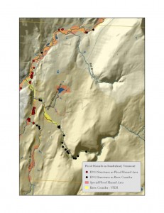
The following is an image of the town of Sunderland and potential structures affected by the flood map changes. Click on the image to view in full size.
FEMA has updated the Flood Insurance Maps for the State of Vermont. Below you will find information about this process. We have PDF’s of the maps listed below and they are also available at the Town Clerks Office and they can be viewed during the Clerk’s standard office hours.
Flood Insurance Info for Sunderland
Letter to the Residents in Sunderland affected by the the new Flood Insurance Maps Sunderland Flood Map Changes – Letter to Residents
Bennington County Flood Hazard Mapping Fact Sheet
Town of Sunderland – Summary Of Map Actions (SOMA)
FEMA MAPS – The below listed maps of Sunderland show the proposed changes to the Flood maps.
Map – Dunham Rd, Maggies Run Rd, Red Mountain Rd
Map – Dunlap Farm Rd, Laver Rd, Sunderland Hill Rd to East Arlington
Map – East Arlington, Kansas Rd, Route 313, South Rd
Map – Hill Farm Rd, North Rd, Sunderland Hill Rd, Borough Rd
Map – Sunderland Hill Rd into Manchester
What is the NFIP?
Congress established the National Flood Insurance Program (NFIP) due to escalating costs to taxpayers for flood disaster relief. The NFIP is based on the agreement that if a community practices sound floodplain management, the Federal Government will make flood insurance available to residents in that community. FEMA maps include the Special Flood Hazard Area, which is the area that has a 1% or greater chance of flooding in any given year. Development may take place within the Special Flood Hazard Area provided that it complies with local floodplain ordinances that meet NFIP criteria.
What is a FIRM?
When FEMA maps flood hazards in a community or county, two products are produced – a Flood Insurance Study (FIS) report and a Flood Insurance Rate Map(FIRM). An FIS is a narrative report of the community’s flood hazards that contains prior flooding information, descriptions of the flooding sources, information on flood protection measures, and a description of the hydrologic and hydraulic methods used in the study. A FIRM illustrates the extent of flood hazards in a community by depicting flood risk zones and the Special Flood Hazard Area, and is used with the FIS report to determine the floodplain development regulations that apply in each flood risk zone and who must buy flood insurance. FIRMs also depict other information including Base (1% annual chance) Flood Elevations (BFEs) or flood depths, floodways, and common physical features such as roads.


